OS Maps Aerial 3D layer
Explore anywhere in Britain with the Aerial 3D map layer in OS Maps.
Learn more about the area you wish to visit including elevation and terrain with a 3D Aerial of your chosen location and route.
Available exclusively to OS Maps Premium users*.
FREE TRIAL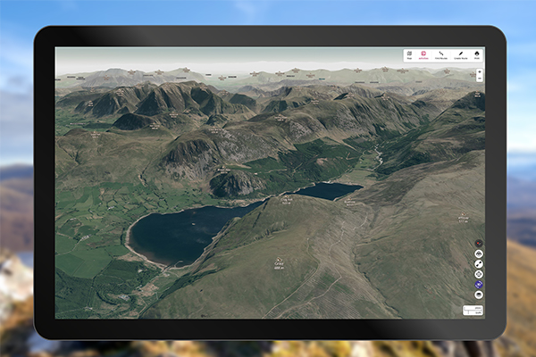
Watch the video
Best of Great Britain's landscapes
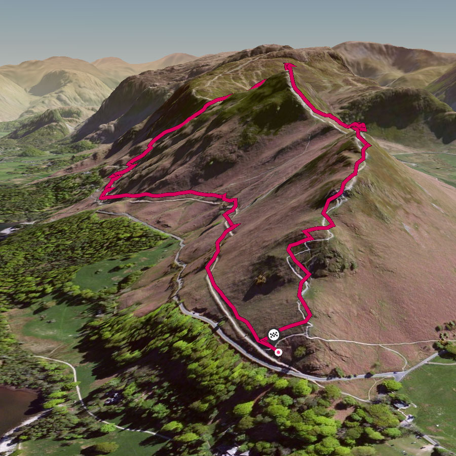
Automatic 3D route fly-through
This useful feature for OS Maps web allows you to fly-through any of the thousands of cycling, running or walking routes in OS Maps; perfect for previewing a planned route, looking back over an activity you’ve just done, or simply browsing for inspiration ahead of your next weekend break or holiday.
New labels highlight nearby hills, towns, woodland and lakes, and an elevation profile tracks progress. The fly-through gives drone-like footage of how steep a route is, how exposed it gets, the terrain underfoot as well as the views you can expect to enjoy.
OS Maps App - Tabletop 3D
View your routes anywhere with the new OS Maps Tabletop 3D augmented reality mode.
Use your device to show a 3D terrain model on any flat surface. Rotate, zoom and change the angle for the best view.
- Open a route - mountain routes work best
- Pull up the route panel and click Tabletop 3D
- Point the camera at a clear flat surface and allow it to 'lock on'; if you don't have a clear table the floor will do
- Click the plus button to start AR mode. Try moving around the 3D model, use pinch to zoom, one finger to move and two fingers to rotate the model
- See you route in Aerial 3D!
Watch the video
Unlock a Premium Subscription *
Try it for FREE
The OS Maps app is full of fantastic features in a complete, digital map of Great Britain. An invaluable tool when you’re out and about.
FREE TRIAL